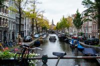
Best Areas to Live in Amsterdam
The best areas to live in Amsterdam are rarely the areas people recommend to visitors. If you are relocating rather than staying a weekend, the questions that decide the answer are practical ones: how long the commute to the Zuidas takes, whether the housing stock can hold your furniture, whether the staircase can take what you are bringing with you, and only then how the neighbourhood feels to live in.
This guide covers nine areas inside Amsterdam and one immediately over its boundary, grouped by the part of the city they sit in. It is the companion to our guide on why people are moving to the Netherlands, which covers the reasons behind the move, and to our Best Places to Live in the Netherlands guide, which looks at the country as a whole and at the towns and villages beyond the city.
Choosing Where to Live in Amsterdam
Four factors decide it, and we would suggest working through them in this order: who is actually moving, the commute, the housing stock, then character. Most published neighbourhood guides start with atmosphere and never reach the other three.
Who Is Moving
This sounds obvious and it is the step most guides skip, because they assume one kind of reader. Amsterdam suits several.
A senior executive relocating to a role at the Zuidas has a different shortlist to a couple whose children have left home and who want a permanent European base. A household moving a collection of art and antiques has different requirements again, and so does someone keeping a smaller apartment in the city alongside a principal residence elsewhere. Families with school-age children have the most constrained search of all, because international school places are finite and the strongest options cluster in a small number of places.
The point is simply that the honest answer to “where should we live in Amsterdam” changes completely depending on which of those you are, and the sections below flag who tends to land where.
The Commute
Amsterdam’s centre of professional gravity has moved south to the Zuidas, and that changes which neighbourhoods are genuinely convenient. Areas that look central on a map can be a slower journey than areas that look peripheral.
Cycling carries far more of the load than a UK arrival tends to expect. 56% of Amsterdam residents who work within the city commute at least partly by bicycle, which reframes distance entirely. A journey that would be unthinkable on foot and slow by car is often fifteen unhurried minutes on a bike.
The Housing Stock
This matters more in Amsterdam than in almost any comparable city, and it is the factor we would push furthest up most people’s list.
The city holds almost 490,000 homes as of early 2025, and a large share of that stock is older, narrower and more vertical than a UK equivalent of the same value. What that means in practice is worth spelling out, because it decides what travels and what does not.
Ceiling heights in the historic centre are generous, which is good news for tall pieces and for hanging art, but the floorplates behind those facades are narrow and the rooms are small, so wall runs long enough for a large canvas or a substantial piece of furniture are scarcer than the ceiling height suggests. Staircases in period buildings are steep, narrow and often turned, and a great many of them genuinely cannot take a wardrobe, a double mattress or a case of any size. That is why so many Amsterdam houses have a hoist beam at the gable, and why an external lift and a first-floor window is frequently the sensible route in rather than the stairs.
Character
Character comes last, which is not the same as saying it does not matter. It is the factor you can only judge properly once the first three have narrowed the field, and it is the one you will live with daily.
One piece of context before the areas themselves. Amsterdam is a compact, historic city of 941,873 residents at the start of 2026, with international migration adding a net 14,000 people during 2025, and it is unusually international by any European measure, with 59% of residents having a migration background as of 2023. Arriving from the UK, you will not feel like an outlier anywhere on this list.
The Historic Centre
The Grachtengordel: Amsterdam’s Canal Ring
The Grachtengordel is the 17th-century canal belt at the centre of the city, inscribed on the UNESCO World Heritage List in 2010, with the protected area covering 198.2 hectares. It is the most recognisably Amsterdam address there is, and it is priced and competed for accordingly.
Four concentric canals make up the ring: the Singel, Herengracht, Keizersgracht and Prinsengracht, built almost entirely between 1610 and 1670 for the merchant families of the Dutch Golden Age. The houses are tall, narrow and deep, most now divided into apartments, some with a smaller rear annexe behind an interior courtyard. Ceilings are generous. Rooms are not.
Who settles here tends to be a mix of long-established Amsterdam residents and international arrivals who specifically want the canal ring rather than a compromise near it. It suits a couple, a single principal, or a household keeping a city apartment alongside a house elsewhere, rather better than it suits a large family. Larger homes with outdoor space are scarce, and a canal frontage is not a garden.
The drawback is tourism. The central stretches carry heavy footfall, tour boats and ambient noise for much of the year, and that is a daily-life factor rather than a seasonal one. If the canal-ring character appeals but the crowds do not, the eastern edge of the historic centre is covered further down under the eastern waterfront.
For commuting this is as central as Amsterdam gets, with almost everywhere in the city a short cycle or tram ride away. The Zuidas is the exception, further out and better served from the south of the city.
The Jordaan: Character at a Premium
The Jordaan was laid out from 1612 as a workers’ and immigrants’ quarter, on a tighter, lower-cost grid than the canal ring immediately beside it. Its narrow, slightly crooked streets survive largely intact, and it is now one of the most sought-after addresses in the city.
Through the 19th century it was Amsterdam’s most densely populated and poorest district, with houses routinely subdivided so several families could live in one. Urban renewal from the mid-20th century, and an influx of artists and young professionals, transformed it. What survives from that history is the street-level community culture and the hofjes, small almshouse courtyards originally built for elderly single women, tucked behind ordinary street frontages.
Be clear-eyed about the housing. Homes here are small, characterful converted houses on narrow streets, and the subdivision that defined the district’s history still shapes its floorplans. Family-sized properties are scarce, and the access considerations are the canal ring’s in a tighter street pattern.
Who lands here tends to be buyers prioritising a walkable, boutique lifestyle over floor area. If you want the character without the tourist density around Anne Frank House, the stretch between the Prinsengracht and the Lijnbaansgracht, running from the Brouwersgracht down towards the Leidsegracht, stays calmer while keeping the same canal-side setting.
Amsterdam Centraal is roughly a fifteen-minute walk from the neighbourhood’s edge, and trams 13 and 17 run to Westermarkt at its entrance. The Jordaan has no metro station of its own, so cycling remains the fastest way to move around.
The Old South and the Zuidas
Oud-Zuid: Amsterdam’s Most Established Address
Oud-Zuid is Amsterdam’s established affluent district, home to the Museum Quarter, Vondelpark, and the highest concentration of the city’s consulates. If one area answers “the posh part of Amsterdam”, this is it.
It divides into three pockets. The Museumkwartier and Willemspark sit around the museums and Vondelpark, with elegant late-19th-century row houses and decorative brickwork. The Apollobuurt, sometimes called the Gold Coast, centres on Apollolaan and Minervalaan, streets named after Greek mythology as part of the 1928 Olympic-era plan, and runs to larger Amsterdamse School apartment blocks and attached houses. The Stadionbuurt near the former Olympic Stadium adds more recent apartment buildings with underground parking.
Housing stock here is larger than the Amsterdam average, which is the practical reason it draws the households it does. Van Eeghenlaan, running directly alongside Vondelpark, is lined with substantial late-19th-century villas, several well over 280 square metres, and properties on it rarely come to the open market. These are among the few homes in the city with the wall runs and the room proportions to take a significant collection without compromise. Family houses with private gardens exist, but they are scarce and highly competitive.
Schooling is part of the draw. The British School of Amsterdam sits at Havenstraat 6, on the district’s edge, and teaches from nursery age through to sixth form, following the National Curriculum for England, and the Amsterdam International Community School is within a workable radius.
The commute draws executives in particular. Several Apollobuurt and Stadionbuurt streets are within walking or cycling distance of the Zuidas, and Station Zuid puts the rest of the network and the mainline connection towards Schiphol within easy reach.
One note on character. Oud-Zuid’s polish can suggest a busy social scene, and residents tend to describe something quieter. Local sources and resident accounts describe the district as calm, green and almost village-like, socially more reserved than its reputation implies. Nor is it exclusively old Dutch money. The wealth here is a mix of long-settled Dutch families and international arrivals, many of whom sold property overseas and settled permanently.
De Pijp: Lively and Well-Connected
De Pijp has the most direct connection to the Zuidas of anywhere in this guide, with Metro Line 52 running from De Pijp station to Amsterdam Zuid in around eight minutes. For a professional working in the financial district who wants to live centrally rather than comfortably near the office, that is a strong practical argument.
The district takes its name from the long, narrow streets built quickly and to a tight budget in the 1870s as Amsterdam’s first major working-class expansion. From the 1960s it became home to migrant communities from Turkey, Morocco, Suriname and the Dutch Antilles, and gentrification from the 1990s onward turned it into one of the city’s more affluent and internationally mixed residential districts. The small-shop, street-market character largely survived the change. The Albert Cuyp market, established in 1905, still runs almost a kilometre along Albert Cuypstraat.
Housing stock is smaller and denser than anywhere else in this guide. These are historically working-class apartments, now thoroughly gentrified, and they suit a couple or a small household rather than a large one with substantial furniture. If floor area is a priority, De Pijp is a less natural fit than the areas either side of it.
Younger professionals form the bulk of the district’s character, though households do settle here for the long term, particularly in the Nieuwe Pijp south of Ceintuurbaan, where housing is larger and Sarphatipark provides the green space.
Rivierenbuurt and Buitenveldert
Rivierenbuurt and Buitenveldert are adjoining districts of Amsterdam Zuid, sitting either side of the Zuidas business district. They are usually mentioned in the same breath and they have almost nothing in common physically. Rivierenbuurt is inter-war, brick and closely planned. Buitenveldert is post-war, green and deliberately open.
Rivierenbuurt
Rivierenbuurt takes its name from its streets, which are named after Dutch rivers. It was laid out in the 1920s and 1930s and executed largely in the Amsterdamse School style, which is why the district reads as a single composition instead of a collection of separate buildings. It runs along the Amstel on one side and the Amstelkanaal to the north, with Beatrixpark and the Martin Luther Kingpark close by.
Residents describe it as village-like and settled, with its own shops and routines despite sitting minutes from the centre and from the Zuidas. English-language guides barely mention it, which is part of why it stays quietly available.
Buitenveldert
Buitenveldert sits immediately south, between the Zuidas and the Amsterdamse Bos. It was built from the late 1950s as a garden-city district under Amsterdam’s general expansion plan, designed around greenery, light and space between the blocks instead of a dense street grid. The 1972 Floriade horticultural exposition, held at what became the Amstelpark, shaped the wide avenues and planting you still see today.
It splits into two halves. Buitenveldert-West is the taller of the two, with more reconstruction-era apartment blocks, and it borders the Amsterdamse Bos. Buitenveldert-West alone holds around 14,300 residents across roughly 7,800 homes, with about 40% of them owner-occupied. Buitenveldert-Oost is roomier, with larger plots, bigger apartment buildings and single-family houses, and it borders the Amstelpark.
Who lands here tends to be quiet, high-income households and established professionals, with a long-standing international presence. Buitenveldert has a Jewish community centred on Kastelenstraat, with schools, synagogues and care facilities, and a long-established Japanese community with its own shops and restaurants. It suits people who have outgrown the centre but want to stay inside the ring. It is practical rather than social, close to shops, the VU Medical Center and the A10, with few restaurants or bars on the doorstep by design. For this audience that quiet is usually the point.
Two honest notes. Buitenveldert sits under flight paths connected to the Buitenveldertbaan, the Schiphol runway that shares the district’s name, and departing aircraft climb over parts of the district. It affects specific pockets rather than the whole area, and it is worth listening for on a viewing.
West and East of the Centre
Oud-West
Oud-West is a dense, characterful district directly west of the canal ring, bordered by Vondelpark to the south. It is central-adjacent rather than central, which is precisely its appeal. You can walk or cycle into the historic core without carrying its footfall.
Four sub-pockets make it up, and they are not interchangeable. Helmersbuurt and Da Costabuurt are the calmer, more residential choices, with quiet streets, hidden gardens and a settled feel. Kinkerbuurt and the Overtoom and Jan Pieter Heijestraat corridor are livelier, with the shopping streets and the traffic that come with them. If you want the district’s character without its noise, look at a side street within Helmersbuurt or Da Costabuurt instead of a frontage on one of the arteries.
De Hallen is the landmark everyone uses to orient themselves here. It was built in phases from 1901 as a municipal tram depot and converted into a food hall, cinema, library and cultural venue, keeping its brick shell and roof trusses.
The housing stock is what decides the move here. Oud-West grew out of Amsterdam’s rapid late-19th-century expansion, and period terraced building of that era dominates. Around 79% of homes in Helmersbuurt were built before 1945, with a meaningful share older still. The stock is not uniform, and you will also find larger double-floor apartments, some 1980s blocks and full period houses, but the prevailing type is the narrow, tall, deep Amsterdam terrace.
Who lives here is international and long-settled, with professionals and established households setting the tone instead of students. Families are part of the mix, as they are in most of this part of the city, but they are not what defines it. For a couple or a smaller household who want period character and want to be able to walk into the centre without living in it, Oud-West is one of the strongest arguments in Amsterdam.
Watergraafsmeer
Watergraafsmeer is a predominantly residential polder district in Amsterdam Oost, reclaimed from the Diemermeer lake in 1629 and among the lowest-lying parts of the city, at around five metres below the Dutch sea-level datum. It was an independent municipality until 1921. It is quiet, green and low-density, and it comes up repeatedly among people who have lived in Amsterdam for a while.
The district divides along the busy Middenweg. To the east sit roomier 1930s apartment developments and family houses, close enough to lively Oost for restaurants and shops without sitting inside the noise. To the west lie Frankendael Park and the green space around it.
Two pockets are worth knowing. Betondorp is a distinctive garden-village enclave designed in 1918 and built through the 1920s, largely in concrete as an experiment in low-cost housing, in a sober, minimalist style that has aged unusually well. Along the Ringdijk, the older canal-side stretch of elegant pre-1930s brick housing preserves traces of the district’s rural past.
The people here are long-established residents and, increasingly, couples and households who have decided that quiet, green and safe beats central. It is not a restaurant or nightlife destination, and it does not need to be, because Oost is next door. Set against the canal-adjacent areas earlier in this guide, Watergraafsmeer is a deliberate choice rather than a compromise, and it is one of the few parts of Amsterdam where a house with a garden is an ordinary proposition.
Trams and the metro serve the district and connections into the centre are direct. It is also close enough to cycle almost anywhere you would routinely go.
On the Water
Amsterdam-Noord and the Dijk Villages
Amsterdam-Noord sits across the IJ river from the centre, connected by ferry and metro rather than by bridge. It was industrial for most of its history and it is now the fastest-changing part of the city. It is also the part most often misjudged, because it is not one place.
Noord splits into three recognised areas. Oud-Noord holds the oldest neighbourhoods, including Nieuwendam and Buiksloot, with small traditional Dutch houses. Noord-West mixes apartment buildings with older and newer houses. Noord-Oost holds the newest development. Alongside those sit NDSM’s industrial and creative redevelopment and Overhoeks’ new-build apartment towers, which is what most visitors see and which is not representative of the district at all.
The Dijk Villages
The dijk villages are the reason Noord belongs on this list. Nieuwendammerdijk, Nieuwendam and Buiksloterdijk are the surviving spine of former independent villages, built as ribbon development along the Waterland sea dike and absorbed into Amsterdam in the early 20th century. Nieuwendam was an independent municipality until 1921. Buiksloot was annexed after a major flood in 1916. The dike street runs on, changing its name as it goes, and historic features remain in place along it, including the old Nieuwendammersluis sluice and the Buiksloterkerk, a former village church parts of which date to 1609.
Physically this is low-rise, older, characterful housing on winding paths instead of a planned grid. It is quiet, traditional and village-like, and it is a completely different proposition from an apartment in Overhoeks.
Noord’s population has become steadily more international and more creative, and the district reads very differently pocket by pocket. The dijk villages suit people who want a quieter, more traditional setting on the water within reach of the city, which is a different profile from NDSM’s younger crowd or Overhoeks’ new-build professionals. Connections are good. Metro 52 runs from Noord through Centraal and on to Zuid, and free ferries cross from behind Centraal several times an hour. Both hubs sit closer to Noord’s newer developments than to the dijk villages, so factor in the onward leg rather than reading a metro map as the whole journey. The A10 ring is reachable by car through the IJ Tunnel.
The Eastern Waterfront: Plantage, Kadijken, the Docklands and IJburg
The eastern waterfront runs from the 19th-century Plantage district beside the city centre, east along the converted warehouse quays at the Kadijken, through the purpose-built Eastern Docklands, and out to the artificial islands of IJburg. It covers roughly two hundred years of building in a few kilometres, and it is the strongest answer in Amsterdam to a request we hear often: the water and the character of the historic city, without the tourist density.
Plantage and Kadijken
The Plantage was laid out from the 17th century as a green enclave and rebuilt from around 1860 with the grand townhouses that define it now. It is one of the quietest parts of central Amsterdam, with wide tree-lined avenues, little through traffic and the cultural and green landmarks on its doorstep.
The Kadijken sit alongside the Entrepotdok, a long row of former warehouses built between 1708 and 1829, squatted in the 1990s and converted into loft apartments that retain their monumental features. Warehouse conversions of this type tend to bring generous ceiling heights, original timber and ironwork.
Oostelijk Havengebied
The Eastern Docklands were working harbour islands until shipping moved west, and the city rebuilt them for housing through the 1990s, each island to its own masterplan. The area now holds around 20,500 residents across roughly 10,600 homes, about 39% of them owner-occupied.
Java-eiland was planned at a domestic scale around inner courtyards and public gardens, and it is the calmer middle ground between full waterfront character and central-adjacent convenience. KNSM-eiland is the more urban of the two, organised along a central avenue and built almost entirely of large 1990s apartment blocks, with ground-level houses rare. Borneo-eiland and Sporenburg, immediately south, are the most residential and architecturally distinctive of the group: around 2,500 mainly low-rise dwellings at high density, ground-accessed three-storey houses reinterpreting the Amsterdam canal house through patios and roof gardens, with open plazas and gardens dispersed through the blocks and two red steel bridges linking the halves.
IJburg
IJburg is Amsterdam’s newest district, built on artificial islands in the IJmeer. The IJburg-West area alone holds around 16,100 residents across 6,830 homes, 72% of them apartments, with 74% of the stock built between 2005 and 2015.
Three parts make it up. Haveneiland is the urban centre, the densest and most apartment-led, with the shops, restaurants and facilities. Steigereiland is where the architect-designed private homes and the floating homes sit. The Rieteilanden, the reed islands, are suburban in character, with detached and dike-style houses, gardens running down to reedy banks.
Connections have just improved. Tram 26, the IJtram, was extended to Strandeiland on 31 August 2026, adding three new stops at Centrumeiland, Buiteneilandlaan and Franz Kafkastraat, with the run from Amsterdam Centraal to the new terminus taking around 25 minutes. The tram is IJburg’s main connection to the centre, and residents report it as considerably more reliable in practice than its reputation suggests, with a replacement bus on the rare occasions it is disrupted. Cycling into the centre is a realistic daily option rather than a weekend one.
IJburg currently draws households trading inner-city density for space and quiet, including a good number of families, and increasingly people who want a modern waterfront home within commuting distance. Its reputation for being remote and dull is a decade out of date and is not what residents describe. It is modern, it is exposed to the weather, and it is the one part of the municipality where a new-build house with a garden, a garage and often a mooring is an ordinary proposition.
Over the Boundary
Amstelveen
Amstelveen is a separate municipality bordering Amsterdam, not a district of the city, and its residents will correct you if you call it a suburb. It became independent on 1 January 1964 and has resisted absorption ever since.
It belongs in an Amsterdam guide because in daily life the boundary barely registers. Trams run in from Amstelveen to Amsterdam Zuid, the northern edge of the town is closer to the Zuidas than much of Amsterdam is, and the Amsterdamse Bos straddles the line. For a household weighing a city address against more space, it is the obvious comparison, and for a senior executive commuting daily to the Zuidas it is often the most sensible answer available.
What it offers is the opposite of most of this guide: two-storey attached houses with private gardens as standard, modern apartment blocks with lifts and parking, and the most concentrated international schooling in the region. Because Amstelveen is a town in its own right rather than an Amsterdam neighbourhood, we cover it properly in our Best Places to Live in the Netherlands guide, alongside the other places just outside the city that relocating households look at seriously.
Beyond the City
A good number of the households we move to the Amsterdam area do not end up in Amsterdam at all. Haarlem sits a short train ride from Centraal with a historic centre of its own. Bloemendaal and Aerdenhout, in the dune belt towards the coast, hold much of the country’s established wealth. The ‘t Gooi villages of Laren, Blaricum and Naarden, east of the city, have been where Amsterdam money has kept a country house since the railways made it practical.
None of those are Amsterdam, and none of them are covered here.
Choosing Between Them
If space is the priority and you want to stay inside the city, look at Buitenveldert, Watergraafsmeer and IJburg first. All three offer what the centre cannot, and they differ mainly in how modern you want the housing to be and how close to the Zuidas you need to sit. Oud-Zuid is the exception that offers space and a central address together, at a price and against real competition for the small number of houses with gardens.
If a Zuidas commute governs the decision, De Pijp, Rivierenbuurt, Buitenveldert and Oud-Zuid are the four to weigh, and Amstelveen belongs in that comparison too.
If central character is what you are moving for, the Grachtengordel and the Jordaan are the two to weigh, accepting that both trade floor area for setting. If you want the historic city without the footfall, the Plantage and the Kadijken do it better than either, and Oud-West gets you walking distance to the centre without living inside it.
If you want water and a house rather than an apartment, Amsterdam-Noord’s dijk villages and the eastern waterfront are the answer.
Whichever area you settle on, the practical side rewards early planning. Older Dutch housing stock, narrow staircases, hoist beams and compact rooms all shape what travels, what is crated and what is placed where on arrival. Our removals from the UK to the Netherlands service is built around exactly that, with a dedicated move coordinator handling the detail from survey through to placement, and our in-house crating workshop building to specification for fine art, antiques and anything else that will not travel in a standard case. You can read more about how we work on our Amsterdam removals service page.
If you are weighing two or three areas and want a clearer view of what the move itself involves, speak to us about a tailored home survey. Surveys can be carried out in person or virtually, and your coordinator will advise on timing once we understand the property at both ends.
To book or ask us a question, call us on 0208 081 0188 or get in touch.